News
Abstract
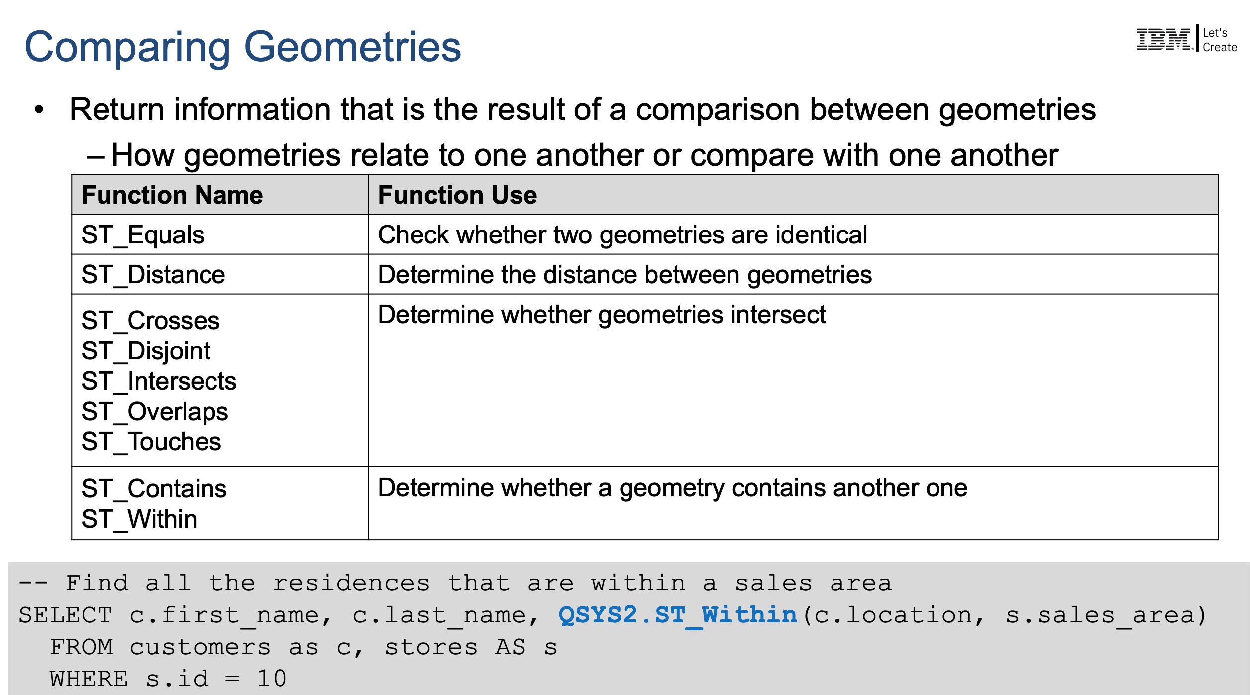
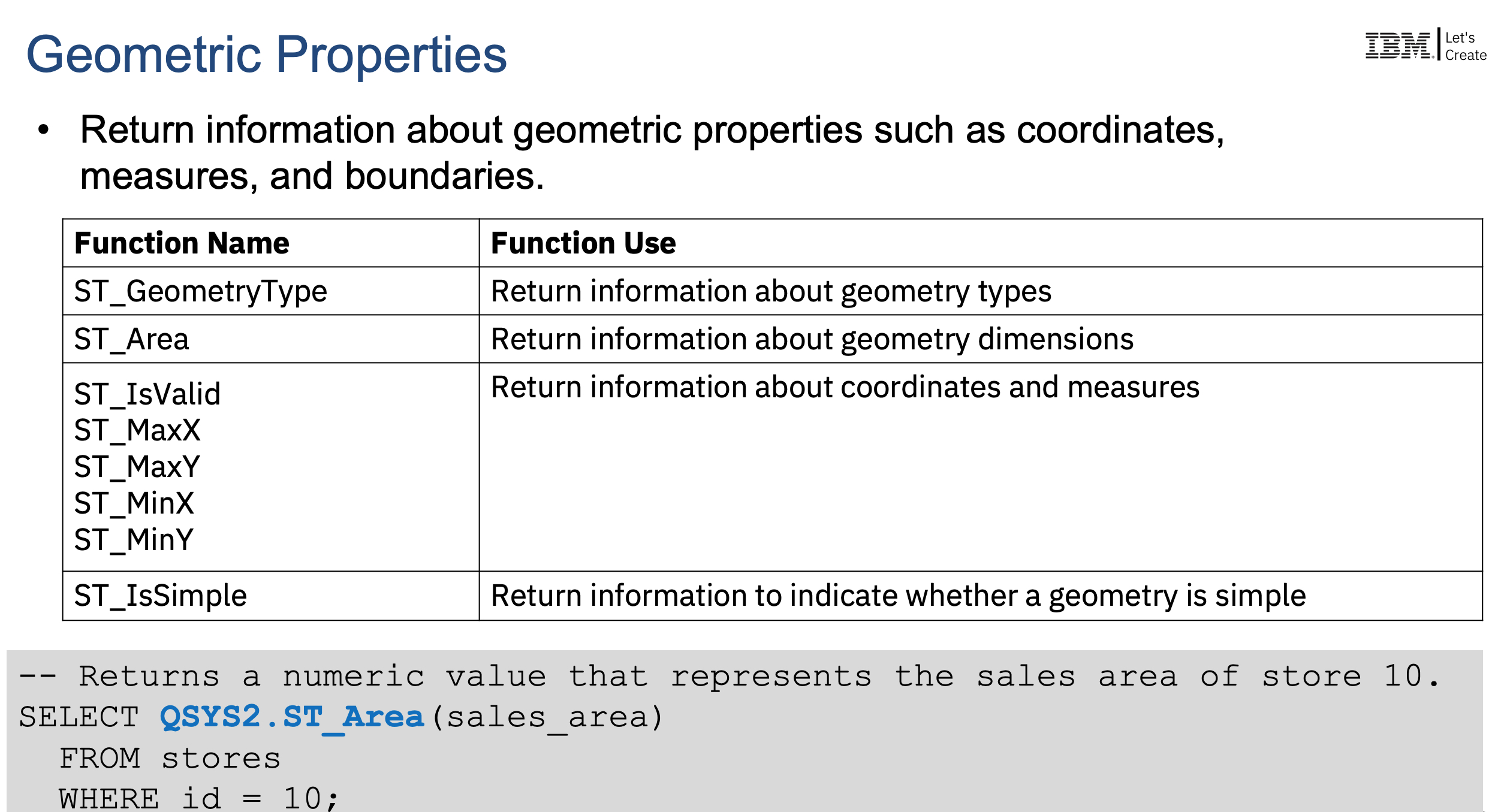
Geospatial functions, with IBM Watson, adds industry-leading technology in the form of Geospatial Analytics to Db2 for i. Geospatial Analytics functions will be part of Db2 for i. With these analytic functions that include projection free Ellipsoidal support and native geohashes, the IBM i client can easily use SQL to leverage Watson Geospatial technology.
Content
You are in: IBM i Technology Updates > Db2 for i - Technology Updates > Db2 for i Functional Enhancements > Geospatial Analytics
Enhanced with IBM i 7.5 SF99950 Level 4 & IBM i 7.4 SF99704 Level 25:
- Add the ST_GEOHASHVALUE scalar function
Enhanced with IBM i 7.5 SF99950 Level 3 & IBM i 7.4 SF99704 Level 23:
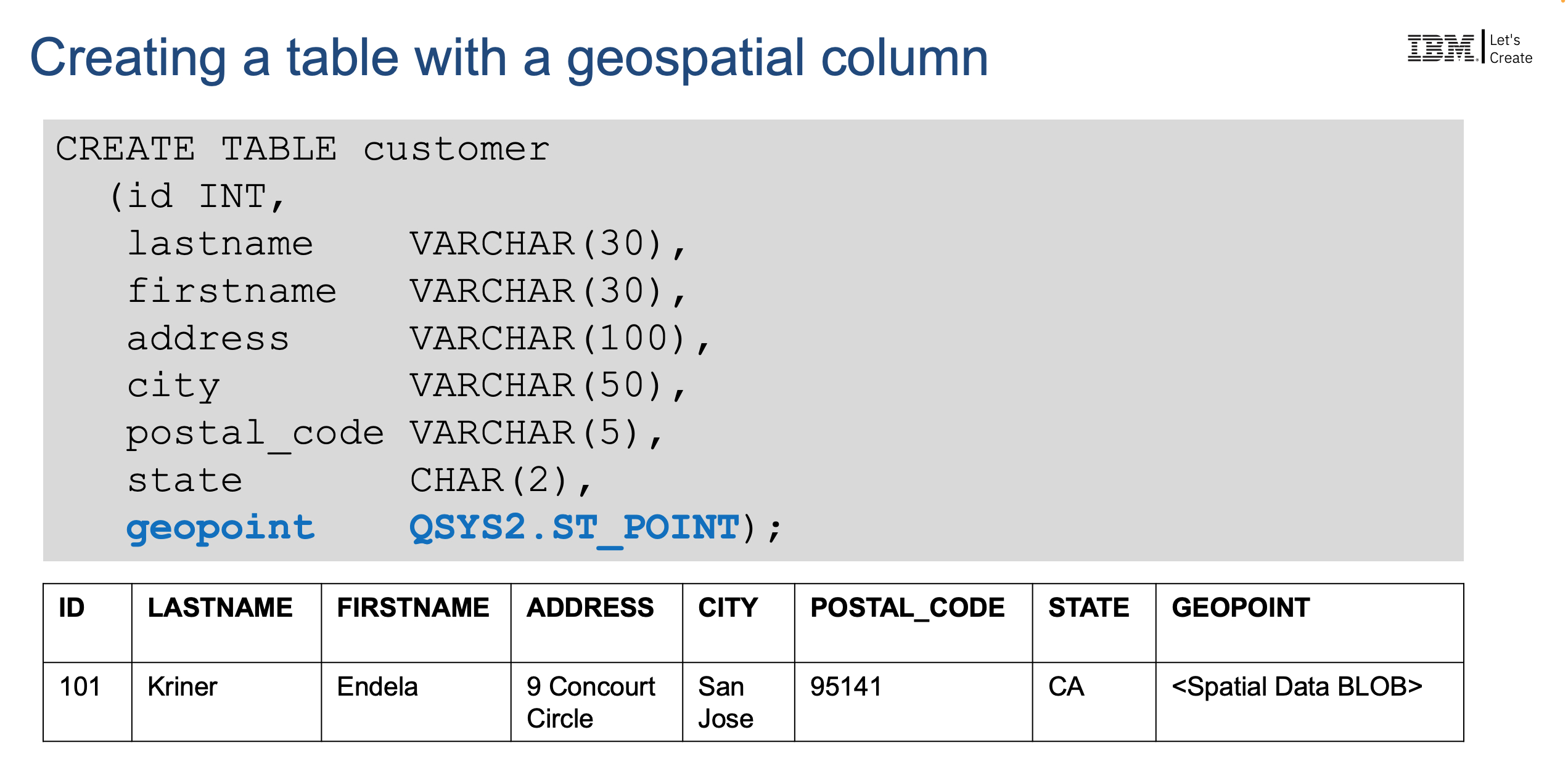
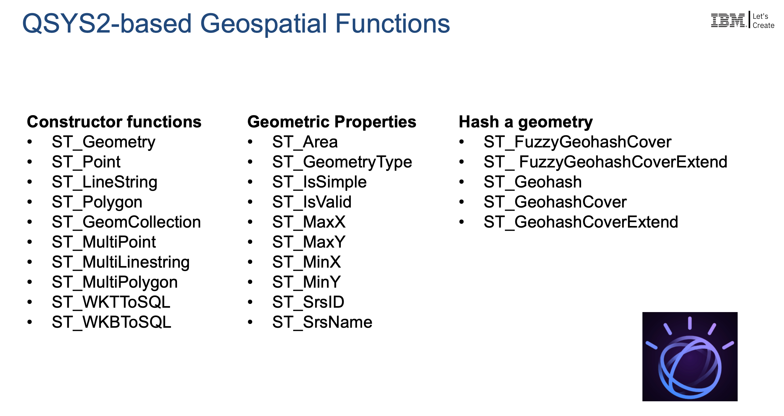
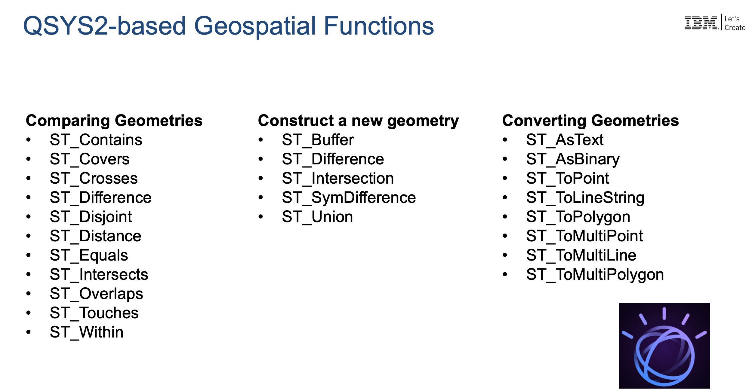
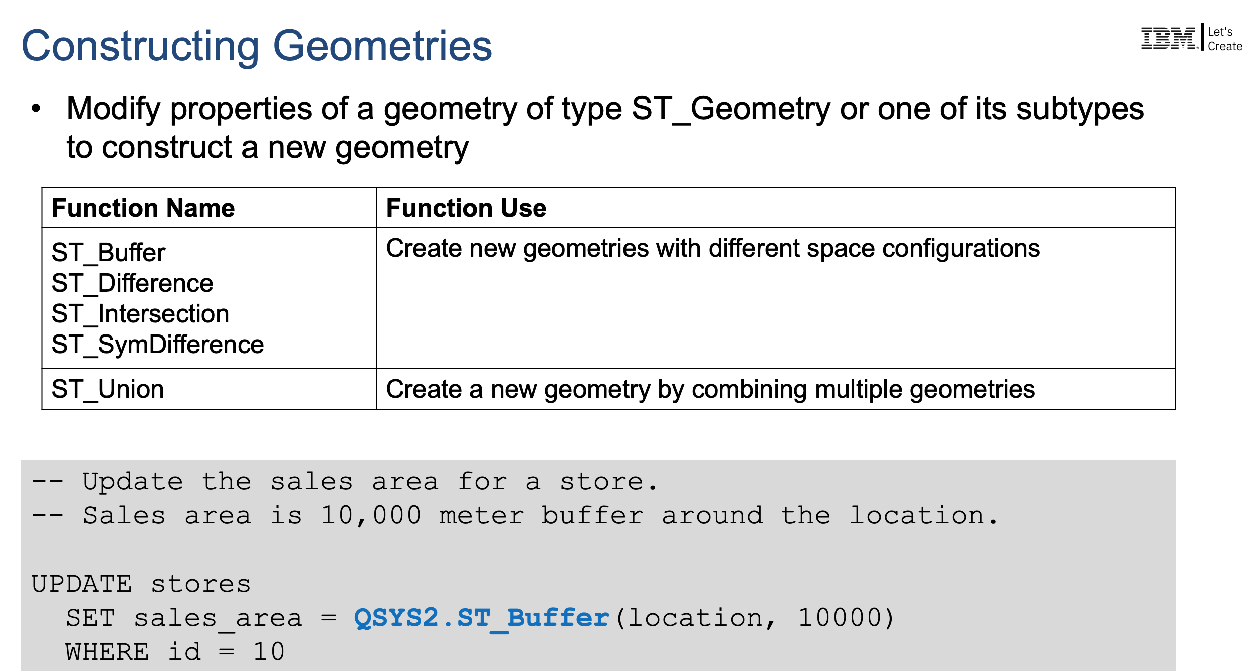
- Add Watson Geospatial Analytics to Db2 for i
See Geospatial Analytics in IBM Documentation for details: Geospatial Analytics



[{"Type":"MASTER","Line of Business":{"code":"LOB68","label":"Power HW"},"Business Unit":{"code":"BU070","label":"IBM Infrastructure"},"Product":{"code":"SWG60","label":"IBM i"},"ARM Category":[{"code":"a8m0z0000000CHeAAM","label":"IBM i Db2"}],"ARM Case Number":"","Platform":[{"code":"PF012","label":"IBM i"}],"Version":"7.4.0;7.5.0;and future releases"}]
Was this topic helpful?
Document Information
More support for:
IBM i
Component:
IBM i Db2
Software version:
7.4.0, 7.5.0 and future releases
Operating system(s):
IBM i
Document number:
6828077
Modified date:
26 March 2025
UID
ibm16828077
Manage My Notification Subscriptions